
Storm Kathleen is set to bring gusts up to 70mph and temperatures reaching 22C in the UK, with yellow weather warnings in place for wind across several regions. Flood warnings have been issued, with concerns of flooding in England and warnings for coastal areas. Met Office predicts the hottest day of the year due to the storm's influence. Ireland is also preparing for the storm, with amber alerts in place in certain regions. Travel disruptions, power cuts, and mobile phone coverage issues are expected, affecting road, rail, air, and ferry services.
The Met Office issued yellow weather warnings for wind, rain, and snow across the UK from Friday. Storm Kathleen is expected to bring gusts of 50-70mph, affecting the west coast of England, Wales, Scotland, and Northern Ireland. Travel disruption, power cuts, and coastal flooding are possible. Ireland's Met Eireann issued warnings, with Cork, Kerry, Galway, and Mayo under an amber alert. Scotland faces snow and rain warnings on Friday. Kathleen is the 11th named storm of the season, reaching winds of over 50mph and associated risks.
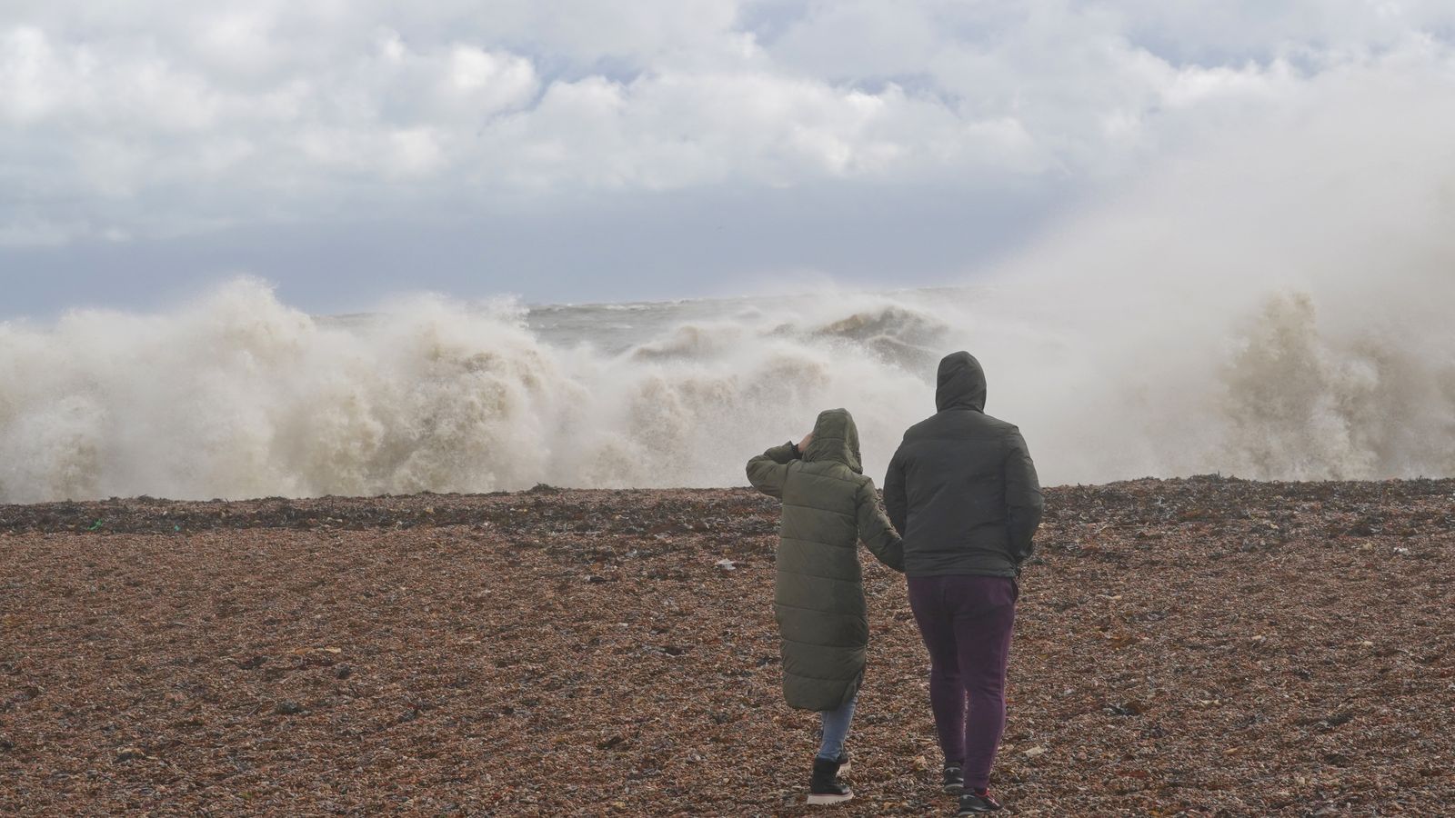
The UK is expected to see temperatures of up to 22C in East Anglia this weekend, making it the hottest day of the year so far in some areas. Strong gusts reaching 50-70mph are forecast in western parts due to Storm Kathleen. Yellow weather warnings have been issued for wind in several regions, with risks of injuries, disruptions to transportation services, power cuts, and potential impact on mobile phone coverage. The warm temperatures are attributed to the storm system and southwest winds.
Storm Isha, the ninth storm since September, is forecast to hit parts of the UK with winds of up to 80mph, bringing heavy rain and posing a potential risk to life and damage to buildings. Amber warnings for wind have been issued for northern and western England, Wales, Northern Ireland, and parts of Scotland. Power cuts, road closures, and disruption to rail and bus services are expected. Yellow warnings for rain and wind are also in place for the rest of the country, with floods likely. Warmer weather is expected alongside the adverse conditions.
An upgraded amber wind warning has been issued for large parts of the UK as Storm Isha is set to bring winds of up to 80mph from Sunday evening into Monday. Injuries and danger to life are likely in coastal areas, and disruption to travel and utilities is expected. Yellow warnings for wind and rain are in place for Scotland, Wales, Northern Ireland, and the South West. The Met Office has also warned of power cuts, damage to buildings, and wintry showers causing transport disruption. Additionally, cold temperatures continue in Scotland, with some areas reaching minus 10C.

The name Kathleen has been used for six tropical cyclones worldwide. In the Eastern Pacific Ocean:Tropical Storm Kathleen (1961) – not a threat to land.Tropical Storm Kathleen (1968) – not a threat to land.Tropical Storm Kathleen (1972) – came close to land.Hurricane Kathleen (1976) – Category 1 hurricane, made landfall in Baja as a tropical storm, moved into California and ArizonaIn the Western Pacific Ocean:Typhoon Kathleen (T4709) – Affected Kantō, JapanIn the Southwest Indian Ocean:Cyclone Kathleen (1965)In Europe:Storm Kathleen (2024)
The Met Office has issued a yellow wind warning for parts of East and West Sussex, with potential disruptions to road, rail, air, and ferry transport as well as the risk of injuries from large waves. Another yellow weather alert for heavy rain is in place for the east coast of Northern Ireland, leading to possible flooding, travel chaos, and power cuts. Unsettled weather is expected across the UK with heavy showers, strong winds, and the likelihood of gales in coastal areas. The Easter Bank Holiday weekend is forecasted to be a washout with showers and windy conditions.
BRITS have been warned of the exact time snow is set to fall tomorrow as the country braces for a chilly weekend. The Met Office predicts there will be flurries of the white stuff over the mountains of Scotland and even in northern England at 2pm on Saturday. Today's forecast for much of the UK begins with "chillier air" and outbreaks of rain are also expected over parts of the Midlands, south Wales and southwest of England. There will also be lots of showers for Scotland, Northern Ireland , northwest England and Wales moving into the afternoon. The Environment Agency has issued four flood warnings and 66 alerts in the last 24 hours following concerns over showers.
The UK is experiencing an Arctic blast with snowfall and freezing temperatures, leading to travel disruption and the risk of injuries. The Met Office has issued yellow weather warnings for snow and ice across parts of the country. Rural communities in the North West are warned of the possibility of being cut off. Motorists are advised to check ahead and plan for disruption, with some roads expected to be untreated. Power cuts are also a potential risk. This week's warnings follow previous snowfall in the South East and flooding from Storm Henk.
Hurricane Kathleen was a Category 1 Pacific hurricane that had a destructive impact in California. On September 7, 1976, a tropical depression formed; two days later it accelerated north towards the Baja California Peninsula. Kathleen brushed the Pacific coast of the peninsula as a hurricane on September 9 and made landfall as a fast-moving tropical storm the next day. With its circulation intact and still a tropical storm, Kathleen headed north into the United States and affected California and Arizona. Kathleen finally dissipated late on September 11.Damage in the United States was considerable. California received record rainfall, with over a foot of rain falling in some areas. Flooding caused catastrophic destruction to Ocotillo, and six people drowned. Flooding extended west; railway tracks were destroyed in Palm Desert and high winds and severe flooding were recorded in Arizona. Overall, the damage total was $160 million (1976 USD, about $760 million in 2023) and 12 deaths were attributed to the storm.
Yellow weather warnings for rain and wind have been issued by the Met Office in the UK, affecting southern, central, and eastern England, with potential rainfall of 30-40mm in some areas and gusts up to 60-70mph. Flood warnings and alerts have been issued, with schools closed in Herefordshire and Worcestershire due to rising flood levels. Rail services in various regions, including Devon, Cornwall, and the West Midlands, have been disrupted. The unsettled weather is expected to clear in the coming days, followed by colder temperatures.
Strong winds of up to 70mph are battering the south coast of England, with heavy showers and hail accompanying the conditions. Yellow weather warnings for wind have been extended by the Met Office, covering parts of Suffolk, East Sussex, and Cornwall. Snow has fallen in parts of South West England and Wales, with temperatures dropping to lows of -1.2C. Over 14 million Britons are expected to make road journeys over the Easter weekend, with potential travel disruptions due to the weather conditions.
The Met Office forecasts heavy rain on Easter Monday with 2.01 million car journeys expected, leading to delays between 10am and 12pm. Showers and heavy rain predicted for much of England and Wales, with Scotland and Northern Ireland experiencing brighter spells. No weather warnings issued, but up to 15mm of rainfall expected. The Environment Agency has already issued flood warnings affecting roads, properties, and farmland. Unsettled weather to continue post-weekend with light winds on Tuesday, although details beyond that are uncertain.
A powerful nor'easter is impacting the Northeast and New England with wind gusts up to 60 mph, heavy rain, and the possibility of feet of snow in some areas. More than 116,000 customers in Maine and 48,000 in New York lost power. The storm is causing disruptions in cities like Boston and New York City, with significant snowfalls expected in interior portions of the Northeast and New England, including up to 3 feet in some areas. Ski resorts in Vermont, New Hampshire, and New York are expected to benefit from the late-season snowstorm.
Winds of up to 70mph have battered the south coast, along with hail and thunder, as millions are set to hit the roads for Easter getaways. The weekend is set to be "unsettled" but "bright and breezy", according to the Met Office forecast. Drivers are being warned of long delays on roads as more than 14 million Easter getaway trips are expected. Find out the forecast for where you live The RAC and transport analysis company Inrix commissioned a survey which suggested 2.6 million leisure journeys by car will be made on Good Friday.
EASTER weekend is expected to be a washout as the Met Office reveals exactly where rain will hit. Rain and showers will fall on the country in all regions at different times, but the North will see dryer spells with patches of sunshine. According to the Met Office the Easter weekend is "likely" to be "unsettled" with rain or showers hitting most regions at different times. But they also said that there could be some "drier and brighter spells". The most affected by rainfall will be in southern and western areas, and later on in the weekend residents in the north will see drier hours and "increased" amounts of sunshine.
The UK is experiencing freezing temperatures and heavy snowfall as cold Arctic air moves south, leading to school closures, travel disruption, and warnings from the Met Office. Tonight could be the coldest January night since 2010, with temperatures potentially dropping to -15C in parts of Scotland. More than 100 schools were closed in Scotland on Tuesday, and train journeys are expected to be affected. The Met Office has issued yellow weather warnings for snow and ice, with up to 10cm of snow forecasted in northwest Scotland. Stormy weather is also expected over the weekend.
The 2023–2024 European windstorm season is the ninth and current season of the European windstorm naming in Europe. The new season's storm names were announced on 1 September 2023. Storms that occur up until 31 August 2024 will be included in this season. This was the fifth season where the Netherlands participated (through KNMI), alongside the United Kingdom's Met Office and Ireland's Met Éireann in the western group. The Portuguese, Spanish, French and Belgian meteorological agencies collaborated for the seventh time, joined by Luxembourg's agency (Southwestern group). This is the third season where Greece, Israel and Cyprus (Eastern Mediterranean group), and Italy, Slovenia, Croatia, Montenegro, North Macedonia and Malta (Central Mediterranean group) named storms which affected their areas.
The Met Office announced that February was the warmest on record in England and Wales since 1884, with a mean temperature of 6.3C. The south of England also experienced its wettest February since 1836, with over double the average rainfall. Winter 2023/24 ranked in the top five warmest and top eight wettest on record for the UK. Climate change is leading to a clear warming trend in winter temperatures, with fewer cold spells expected, impacting plant growth. The UK is projected to have warmer and wetter winters in the future, preparing for both extremes.


''

Sky News

https://www.facebook.com/bbcnews
''

PA Media
https://www.facebook.com/bbcnews
Sky News
PANORA
PANORA
PANORA
PANORA
Wikipedia
PANORA
PANORA
PANORA
Wikipedia
PANORA
PANORA
PANORA
PANORA
PANORA
PANORA
PANORA
Wikipedia
PANORA